Plain of Six Glaciers, Banff National Park, Alberta, Canada

On Tuesday, we returned to Lake Louise, getting an early start, driving to the overflow parking lot and taking a shuttle bus to the lake. The sky was notably clearer today. It was a nice reprieve from the smoke, and nice to see blue skies. The mountain seen directly in the center is Mount Victoria, home to Victoria Glacier. On this day, we were hiking in that direction, to the Plain of Six Glaciers.

Lake Louise, Banff National Park, Alberta, Canada

Lake Louise

The hike began by moving counterclockwise around the northwest side of the lake, at first on level ground.

Here we have reached the far end of Lake Louise, which is fed by run-off from the glaciers:

Lake Louise, Banff National Park, Alberta, Canada

Lake Louise

We began gaining elevation. This was the wall to our right, i.e., northwest of the trail:

Wall Northwest of Trail, Banff National Park, Alberta, Canada

Wall Northwest of Trail

There were still some wildflowers to be seen. While the sky is overexposed in this photo, I like the contrast of the grass, flowers, trees, mountains, glaciers, and sky. The center of this photo features Mount Lefroy:

Wildflowers and Mount Lefroy, Banff National Park, Alberta, Canada

Wildflowers and Mount Lefroy

Here we have another view of Mt. Lefroy and to the right, Mt. Victoria, with Victoria Glacier. To the right of the photo is our trail, continuing on closer to the glaciers:

Mt. Lefroy and Mt. Victoria, Banff National Park, Alberta, Canada

Mt. Lefroy and Mt. Victoria

Here is Batya on the trail, with Lake Louise barely visible on the right side of the photo:

Batya posing on the trail, Banff National Park, Alberta, Canada

Batya posing on the trail

This is a stitched panorama, showing Mt. Lefroy on the left, Mt. Victoria in the center, and Collier Peak on the right:

Mts. Lefroy and Victoria, Collier Peak, Banff National Park, Alberta, Canada

Mts. Lefroy and Victoria, Collier Peak

The seasonal snow was long gone by this time of year, but the glaciers were still there, providing a little water as the sun melted a tiny portion of them:

Snowmelt from Collier Peak, Banff National Park, Alberta, Canada

Snowmelt from Collier Peak

We were nearing the end of the trail. Here, a man hiking in front of us can be seen for scale:

Knife-Edge Trail, Banff National Park, Alberta, Canada

Knife-Edge Trail

The same trail and the man can be seen at the far right in this stitched panorama, showing Mt. Lefroy at center, with Mt. Victoria (and Victoria Glacier) to the right:

Mts. Lefroy and Victoria, Banff National Park, Alberta, Canada

Mts. Lefroy and Victoria

Lake Louise was again visible as we looked back from our starting point:

Looking back toward Lake Louise, Banff National Park, Alberta, Canada

Looking back toward Lake Louise

The trail seemed to end at the bottom of a scree slope. There was no sign indicating it was the end of the trail, but a large number of people were sitting and standing there. The spot provided a nice view of Abbot Pass between Mount Lefroy and Mount Victoria:

Abbot Pass, Banff National Park, Alberta, Canada

Abbot Pass

Zooming in on the pass:

Abbot Pass, Banff National Park, Alberta, Canada

Abbot Pass

Zooming to 200mm, my telephoto lens captured the alpine hut at the top of Abbot Pass, constructed in 1922:

Hut on Abbot Pass, Banff National Park, Alberta, Canada

Hut on Abbot Pass

Another tourist was kind enough to photograph us below the pass:

Charlie and Batya below Abbot Pass, Banff National Park, Alberta, Canada

Charlie and Batya below Abbot Pass

We began hiking back. Here is yet another view of Lake Louise in the distance:

Lake Louise, Banff National Park, Alberta, Canada

Lake Louise

This Colombian ground squirrel was a small fellow, so I presume it was a youngster:

Young Colombian Ground Squirrel, Banff National Park, Alberta, Canada

Young Colombian Ground Squirrel

There is also a teahouse on the trail of the Plain of Six Glaciers:

Batya at the Plain of Six Glaciers Teahouse, Banff National Park, Alberta, Canada

Batya at the Plain of Six Glaciers Teahouse

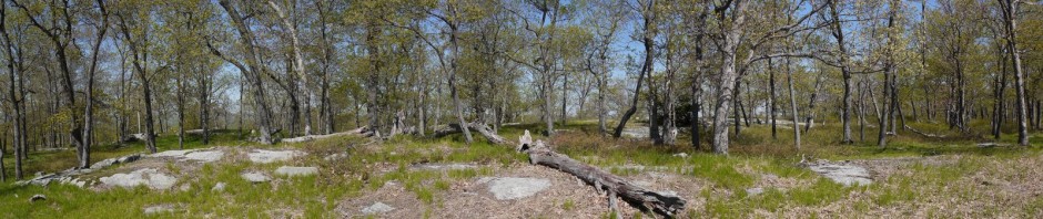
It looks as though there was a landslide at one point in this location:

Slide, Banff National Park, Alberta, Canada

Slide

We reached the lake, and soon completed our last hike in Banff:

Lake Louise and Fairmont Chateau, Banff National Park, Alberta, Canada

Lake Louise and Fairmont Chateau

The Plain of Six Glaciers hike is about 8.7 miles (14 km), with an elevation gain of about 1925′ (587 m). The hike did not seem especially strenuous to us.

The next day, we would check out of our hotel in Canmore, have one last hike in the area, and then drive back to Calgary for our flight home.

Posted in Hikes, Vacations | Tagged | Leave a comment

Sulphur Mountain, Banff National Park, Alberta, Canada

After the previous day’s long hike, we decided to take it easy. We drove to the Town of Banff, within the national park. Whereas Canmore, where we were staying, has a population of about 14,000, the Town of Banff has fewer than 8,000 people. Banff is much smaller, though, and therefore has about 8 times the population density of Canmore.

In Banff, we drove to the base of Sulphur Mountain, where we took the gondola to the top. Here, too, our copy of the Lonely Planet failed us. Published in April 2016, the edition alleged that the gondola trip was $40 (Canadian) for an adult. Instead, each ticket was $64. Of course, perhaps the price had been $40 two years earlier when the book was being prepared for publication, but in any case, a price increase of over 50% seems unreasonable over a two-year period. Nevertheless, what I considered a high price for an eight-minute ride didn’t deter the hordes of tourists.

After eight minutes, we were 670m (2200′) higher, at the top of Sulphur Mountain. The gondola terminal at the top of the mountain was a three-story building that included a restaurant, gift shop, small museum, and observation deck.

Here is the view looking due north, toward the Town of Banff and Tunnel Mountain:

Town of Banff and Tunnel Mountain, Banff National Park, Alberta, Canada

Town of Banff and Tunnel Mountain

This is a stitched panorama facing southwest, toward the Sundance Range:

Sundance Range, Banff National Park, Alberta, Canada

Sundance Range

Batya on the observation deck, with a mirrored bear:

Batya with mirrored bear, Banff National Park, Alberta, Canada

Batya with mirrored bear

This is the view looking northwest, toward Sanson’s Peak, one of the high spots on Sulphur Mountain:

Sanson's Peak, Banff National Park, Alberta, Canada

Sanson’s Peak

We walked along the boardwalk and soon reached Sanson’s Peak, where a small meteorological observatory building is still standing. This view is facing the northwest:

Batya and Charlie on Sanson's Peak, Banff National Park, Alberta, Canada

Batya and Charlie on Sanson’s Peak

This is a view from Sanson’s Peak back toward the southeast, showing the gondola terminal atop Sulphur Mountain:

Gondola Terminal on Sulphur Mountain, Banff National Park, Alberta, Canada

Gondola Terminal on Sulphur Mountain

Back at the observation deck on Sulphur Moutain, I took a 200-degree panorama of the view centered on the west. Thus, the left side of the panorama shows a helipad adjacent to the gondola terminal and the southeast peak, the central part of the panorama shows the Sundance Range of mountains to the west, and the right side of the panorama shows  Sanson’s Peak to the northwest:

Stitched Panorama from Observation Deck of Sulphur Mountain, Banff National Park, Alberta, Canada

Stitched Panorama from Observation Deck of Sulphur Mountain

Having spent about two hours at the top, we rode the gondola down the mountain. We had to share the four-person gondola with another couple, who boarded first and faced each other, so we had to do the same, rather than sitting side-by-side. This gave me the opportunity to photograph Batya enjoying the ride:

Batya enjoying the gondola ride, Banff National Park, Alberta, Canada

Batya enjoying the gondola ride

The view from the gondola, looking east

View from the gondola on Sulphur Mountain, Banff National Park, Alberta, Canada

View from the gondola on Sulphur Mountain

For those wanting a workout and not wanting to spend big bucks for an 8-minute ride, a nice hiking trail with numerous switchbacks works its way up and down the mountain:

Hiking trail up Sulphur Mountain, Banff National Park, Alberta, Canada

Hiking trail up Sulphur Mountain

Our next stop was the Cave & Basin National Historic Site, where admission was free when we showed our park pass. The Banff National Park, and indeed the entire Canadian national park system, had its origin here, when Canadian Pacific Railway employees “discovered” the hot springs (known to the indigenous people long before). Thermal treatments were considered healthful, and businesses began proliferating. This led the government to step in and declare a national park in order to preserve the springs.

This is the original cave:

Cave & Basin National Historic Site, Banff National Park, Alberta, Canada

Cave & Basin National Historic Site

There was also a small museum at the site. Outside, we enjoyed a 2.3km (1.4 mile) level hike known as the Marsh Loop.

This photo from the Marsh Loop shows Mt. Norquay to the left, and Cascade Mountain to the right:

Mt. Norquay and Cascade Mountain, Banff National Park, Alberta, Canada

Mt. Norquay and Cascade Mountain

A high dynamic range photo of Mt. Norquay:

x, Banff National Park, Alberta, Canada

Mt. Norquay

Our last stop in Banff was a visit to Cascades of Time Garden (also called Cascade Garden).  :

Cascades of Time Garden, Banff National Park, Alberta, Canada

Cascades of Time Garden

The gardens, which date to 1935, include the Parks Canada administration building:

Parks Canada Administration Building, Banff National Park, Alberta, Canada

Administration Building

The park includes about 50,000 annuals that are tended to by the staff. The garden can typically be enjoyed from May until September, depending upon the weather:

Flowers at Cascades of Time, Banff National Park, Alberta, Canada

Flowers at Cascades of Time

In addition to the flowers, planted on terraces, the park includes stone walls, ponds, and a number of gazebos made with burl wood:

Cascades of Time Garden, Banff National Park, Alberta, Canada

Cascades of Time Garden

If you are in Banff in the summer, it’s worth a trip to the gardens.

Batya in Cascades of Time, Banff National Park, Alberta, Canada

Batya in Cascades of Time


Posted in Vacations | Tagged | Leave a comment

Healy Pass and Simpson Pass, Banff National Park, Alberta, Canada

We spent Saturday (our Sabbath) in Canmore, enjoying a nice walk through downtown in the afternoon. When we had checked into our room on Monday afternoon, I noticed a black and white rabbit hopping around outside, and correctly inferred that it was a domestic rabbit, as wild rabbits are brown (other than the winter morph of the snowshoe hare).  On Saturday afternoon, I noticed additional rabbits hopping around town, and saw some establishments that had placed pans of water out for them. I later learned that the rabbits date from the 1980s, when someone released them. They are considered undesirable, out of fear that predators will enter Canmore to eat the rabbits, and possibly then endanger dogs or even people.

Canmore is allegedly trying to eradicate the rabbits, but their efforts haven’t accomplished much other than waste money, and there are many rabbit lovers who oppose the efforts.

On Sunday, we returned to Banff, driving again to Sunshine Village. This time, we weren’t contemplating taking the shuttle bus to the easy Garden Path Trail, but instead had set our sights on the moderate/difficult Healy Pass and Simpson Pass hike.

We began hiking southwest on the Healy Pass Trail:

Healy Pass Trail, Banff National Park, Alberta, Canada

Healy Pass Trail

The trail began passing through a wooded area:

Woods adjacent to Healy Pass Trail, Banff National Park, Alberta, Canada

Woods adjacent to Healy Pass Trail

We soon crossed over Sunshine Creek:

Sunshine Creek, Banff National Park, Alberta, Canada

Sunshine Creek

Another view:

Sunshine Creek, Banff National Park, Alberta, Canada

Sunshine Creek

There were a few colorful wildflowers, as can be seen in this (mostly-unfocused) photograph:

Wildflowers, Banff National Park, Alberta, Canada

Wildflowers

The trail continued, running parallel with Healy Creek, though the water wasn’t always visible. After 5.9 km (3.7 miles), we came to the junction with the Lower Simpson Pass Trail, but we continued on the Healy Pass Trail. Over the next 1.8 km (1.1 mile), when we reached another junction, with the Simpson Pass Trail, the trees began to thin out, offering more expansive views.

We continued on the Healy Pass Trail, now hiking northwest. Here is a stitched panorama from the Healy Pass Trail:

Stitched panorama from Healy Pass Trail, Banff National Park, Alberta, Canada

Stitched panorama from Healy Pass Trail

Another stitched panorama

Stitched panorama from Healy Pass Trail, Banff National Park, Alberta, Canada

Stitched panorama from Healy Pass Trail

The Healy Lakes were visible, but the smoke from the British Columbia fires continued to plague us:

Healy Lakes, Banff National Park, Alberta, Canada

Healy Lakes

Batya on the Healy Pass Trail:

Batya on the Healy Pass Trail, Banff National Park, Alberta, Canada

Batya on the Healy Pass Trail

We were not the faster hikers, and were always courteous to allow others to pass, whether they were going in the same direction as us, or in the opposite direction. As we reached the Healy Pass, we allowed one group of German men to pass us.

After about another mile, we finally reached a large boulder which presumably marked Healy Pass, but the German men who had passed us had planted themselves on the boulder. In fact, as we approached, they grabbed their backpacks and put them on the boulder next to themselves, blocking any possibility for us to sit down. We instead had to sit on the ground nearby, and to each lunch there.

View from Healy Pass, Banff National Park, Alberta, Canada

View from Healy Pass

I said that I imagined that the boulder marked the location of the Healy Pass. I was surprised that there was no explicit signage to confirm this. There also seemed to be two trails continuing on from this point, whereas the National Geographic map that I had brought only showed one: the Healy Pass Trail continuing to Egypt Lake. Those continuing on were most likely going to be spending at least one night camping. We were only interested in a day hike, so we continued no further.

We retraced our steps southeast on the Healy Pass Trail, and when we reached the junction, we turned south onto the Simpson Trail. At Healy Creek, I spotted a few small fish in the water, which I think are cuthroat trout (Oncorhynchus clarkii):

Cutthroat trout, Banff National Park, Alberta, Canada

Cutthroat trout

The Simpson Pass Trail offered a number of nice meadows, many with streams or ponds, and with mountains in the background:

Meadow on Simpson Pass Trail, Banff National Park, Alberta, Canada

Meadow on Simpson Pass Trail

Another:

Meadow on Simpson Pass Trail, Banff National Park, Alberta, Canada

Meadow on Simpson Pass Trail

Wildflowers:

Wildflowers, Banff National Park, Alberta, Canada

Wildflowers

Another meadow:

Meadow on Simpson Pass Trail, Banff National Park, Alberta, Canada

Meadow on Simpson Pass Trail

More scenery on the Simpson Pass Trail. This appeared to be a small lake, though it is not named on my map:

Lake off Simpson Pass Trail, Banff National Park, Alberta, Canada

Lake off Simpson Pass Trail

This clearing looked like an inviting place to take a nap, but we had miles to go:

A clearing off the Simpson Pass Trail, Banff National Park, Alberta, Canada

A clearing off the Simpson Pass Trail

The Simpson Pass Trail finally left the meadows and clearings behind, and for a while entered a more forested area:

Simpson Pass Trail, Banff National Park, Alberta, Canada

Simpson Pass Trail

After 2.3 km (1.4 miles), we reached the Simpson Pass. Unlike the Healy Pass, the Simpson Pass did not offer a spectacular view, but it marked the boundary between Banff and Mount Assiniboine Provincial Park, as well as the boundary between Alberta and British Columbia:

Border between Banff (in Alberta) and Mt. Assiniboine Provincial Park (in British Columbia), Banff National Park, Alberta, Canada

Border between Banff (in Alberta) and Mt. Assiniboine Provincial Park (in British Columbia)

Batya at the border between the provinces:

Batya at the border between Alberta and British Columbia, Banff National Park, Alberta, Canada

Batya at the border between Alberta and British Columbia

A chubby Columbian ground squirrel (Urocitellus columbianus) was welcoming visitors at the border:

Columbian ground squirrel, Banff National Park, Alberta, Canada

Columbian ground squirrel

We then turned north onto the Lower Simpson Pass Trail:

Lower Simpson Pass Trail, Banff National Park, Alberta, Canada

Lower Simpson Pass Trail

View from Lower Simpson Pass Trail:

View from Lower Simpson Pass Trail, Banff National Park, Alberta, Canada

View from Lower Simpson Pass Trail

Indian Paintbrush (Castilleja miniata):

Indian Paintbrush, Banff National Park, Alberta, Canada

Indian Paintbrush

After 1.3 km (0.8 miles), the Lower Simpson Pass Trail ended at the intersection with the Healy Pass Trail. Here Batya crosses a narrow footbridge at the junction:

Batya crossing bridge at junction of Healy Pass Trail and Lower Simpson Pass Trail, Banff National Park, Alberta, Canada

Batya crossing bridge at junction of Healy Pass Trail and Lower Simpson Pass Trail

We then retraced our steps northeast for 5.9 km (3.7 miles) on the Healy Pass Trail, until we arrived back at Sunshine Village. The hike was 19 km (11.8 miles), said to have an elevation gain of about 959 m (3,100′). I’m not sure the elevation gain is accurate, as while it was a challenging hike, the distance was more challenging than the elevation change.


Posted in Hikes, Vacations | Tagged | Leave a comment

Lake Agnes and Beehives, Banff National Park, Alberta, Canada

We made sure to wake up early on Friday, as we planned to hike at Lake Louise, and also needed to be back at our hotel in Canmore in time to prepare for the Sabbath, which began at 8:40 p.m.

We drove to the Overflow Lot south of Lake Louise, and waited in line for one of the free shuttle buses. These appeared to be ordinary yellow school buses. Perhaps the buses serve students through the school year, and serve tourists at the national parks during the summer months.  The employee assisting us with boarding the bus offered a couple of jokes:

“Question: What do you call a bear without teeth?”
“Answer: A gummy bear.”

“Question: How many tickles does it take to make an octopus laugh?”
“Answer: Ten tickles.”

The bus dropped us off in a parking lot adjacent to Lake Louise, and we soon  enjoyed the view, or as much of it as could be enjoyed through the smoky haze that was courtesy of the fires in British Columbia:

Lake Louise, Banff National Park, Alberta, Canada

Lake Louise

Hundreds of tourists were circulating along the promenade adjacent to the northeastern end of lake, but the numbers dropped off as we began our hike to Lake Agnes.

This slightly out-of-focus Columbian ground squirrel (Urocitellus columbianus) was running around the lawn adjacent to the hotel:

Columbian ground squirrel, Banff National Park, Alberta, Canada

Columbian ground squirrel

We hiked southwest along the western side of Lake Louise, and the trail soon entered the woods:

Trail to Lake Agnes, Banff National Park, Alberta, Canada

Trail to Lake Agnes

The trail displayed some signs of erosion, and this dead tree looked as though it would soon be tumbling out of the eroded bank, hopefully not when anyone was walking past it.

Dead tree in eroded bank, Banff National Park, Alberta, Canada

Dead tree in eroded bank

A golden-mantled ground squirrel:

Golden-mantled ground squirrel, Banff National Park, Alberta, Canada

Golden-mantled ground squirrel

After 2.6 km (1.6 miles) we reached Mirror Lake, which seemed more of a pond than a lake. I noted that the signage gave the distances in mileage, indicating that the sign predated the 1980 metrification of Canada.

Sign with imperial measurements, Banff National Park, Alberta, Canada

Sign with imperial measurements

Mirror Lake with Big Beehive:

Mirror Lake with Big Beehive, Banff National Park, Alberta, Canada

Mirror Lake with Big Beehive

We continued on the trail to Lake Agnes, enjoying a side view of the Big Beehive:.

Big Beehive, Banff National Park, Alberta, Canada

Big Beehive

Horses also used part of the trail, and we saw a group of them:

Horses on Lake Agnes trail, Banff National Park, Alberta, Canada

Horses on Lake Agnes trail

After another 0.8 km (0.5 miles) we reached Lake Agnes and the teahouse, where visitors can purchase meals and snacks:

Lake Agnes, Banff National Park, Alberta, Canada

Lake Agnes

A pair of golden-mantled ground squirrels:

Golden-mantled ground squirrels, Banff National Park, Alberta, Canada

Golden-mantled ground squirrels

We began climbing toward the Little Beehive, only about 0.8 km (0.5 miles) away, but gaining a bit of elevation.

We soon had a nice view of Mirror Lake and Lake Louise:

Mirror Lake and Lake Louise, from Little Beehive trail, Banff National Park, Alberta, Canada

Mirror Lake and Lake Louise, from Little Beehive trail

Nearing the peak of the Little Beehive:

Nearing the peak of the Little Beehive, Banff National Park, Alberta, Canada

Nearing the peak of the Little Beehive

Batya attracted a friendly butterfly:

Batya attracted a butterfly, Banff National Park, Alberta, Canada

Batya attracted a butterfly

Here is a panoramic view from the top of the Little Beehive. Lake Louise is visible to the right, but the rest of the horizon only shows smoky skies, where there should be mountain ranges:

Panoramic view from Little Beehive, Banff National Park, Alberta, Canada

Panoramic view from Little Beehive

As we sat down to eat our lunch at the top of Little Beehive, a bird flew nearby. It was a gray jay (Perisoreus canadensis), the “camp robber,” my old nemesis who I had last seen in Rocky Mountain National Park, where it stole a piece of my sandwich.

Gray jay, Banff National Park, Alberta, Canada

Gray jay

We descended from Little Beehive back to Lake Agnes, and began hiking west along the lake’s northern side:

Trail on northern side of Lake Agnes, Banff National Park, Alberta, Canada

Trail on northern side of Lake Agnes

Terrain adjacent to Lake Agnes:

Terrain adjacent to Lake Agnes, Banff National Park, Alberta, Canada

Terrain adjacent to Lake Agnes

We soon reached the southwestern end of Lake Agnes:

View along the length of Lake Agnes, from the southwestern end, Banff National Park, Alberta, Canada

View along the length of Lake Agnes, from the southwestern end

The trail to the Big Beehive continued on the southern side of Lake Agnes, appearing as a narrow ribbon in the image below:

Trail to Big Beehive, Banff National Park, Alberta, Canada

Trail to Big Beehive

The trail soon began to switchback, continually climbing the Big Beehive:

Switchback to Big Beehive, Banff National Park, Alberta, Canada

Switchback to Big Beehive

Another switchback:

Switchback to Big Beehive, Banff National Park, Alberta, Canada

Switchback to Big Beehive

I counted nine switchbacks, and they were a bit taxing, but we finally made it to the top of the Big Beehive, at 2270 m (7,448′). At the top, we followed a flat trail to a shelter constructed by the Canadian Pacific Railway in 1916. The shelter was very simple, and I wondered how often it had been rebuilt over the intervening century. Perhaps it was like George Washington’s axe,  that was still called by that name despite the handle and head each having been replaced a few times.

Shelter on top of Big Beehive, Banff National Park, Alberta, Canada

Shelter on top of Big Beehive

The shelter, and a ledge adjacent to it, provided a fine view of Lake Louise. Well, it should be a fine view, of a vivid turquoise lake, but . . .  again, the forest fires ruined it:

Lake Louise, from the top of the Big Beehive, Banff National Park, Alberta, Canada

Lake Louise, from the top of the Big Beehive

Another view:

Lake Louise, from the top of the Big Beehive, Banff National Park, Alberta, Canada

Lake Louise, from the top of the Big Beehive

We then retraced our steps down the switchbacks, around Lake Agnes, past Mirror Lake, and back to Lake Louise. This was about a 12.9 km (8 mile) hike, gaining 740 m (2,400′) in elevation. Considering our initial trepidation about long or steep hikes, after not having hiked in almost a year, we were doing well in Banff!

We boarded the shuttle bus around 5:00 p.m., with about a half hour to spare before the last bus. We were soon back at the Overflow Parking area and reunited with the rental car, and drove back to Canmore.

Posted in Hikes, Vacations | Tagged | Leave a comment

Icefields Parkway, Banff National Park to Jasper National Park, Alberta, Canada

On Thursday, our legs were feeling a bit tired after the previous day’s hike, so we decided to just take a driving tour, instead of hiking. We only have a few photos to show this day.

We drove from Canmore up into Banff National Park on the Transcanada Highway, making our way to the slower and more scenic Icefields Parkway. Our first stop was at the Crowfoot Glacier Viewpoint. The glacier is visible at the left center of the image, to the right of the tops of the trees. Early explorers named the glacier “Crowfoot” after observing that it appeared to have three toes; sadly, one of those toes has since melted.

Crowfoot Mountain and Crowfoot Glacier, Banff National Park, Alberta, Canada

Crowfoot Mountain and Crowfoot Glacier

Crowfoot Glacier is just south of Bow Lake, and we continued north a short while, stopping for coffee at the gift shop of Simpson’s Num-Ti-Jah Lodge at the northern end of the lake.

Wildflowers at Simpson's Num-Ti-Jah Lodge, Banff National Park, Alberta, Canada

Wildflowers at Simpson’s Num-Ti-Jah Lodge

Crowfoot Mountain from Num-Ti-Jah:

Crowfoot Mountain from Num-Ti-Jah, Banff National Park, Alberta, Canada

Crowfoot Mountain from Num-Ti-Jah

We drove a few more miles north, to Bow Summit, which at 2085 m (6840′) is the highest point on the Icefields Parkway. It is the watershed divide for the Bow River (to the south) and the Mistaya River (to the north). We walked along a paved trail for 1.2 km (0.7 miles) to an overlook of Peyto Lake, which has a turquoise color thanks to suspended rock particles. As noted for previous days, my photography was hampered by smoke from the forest fires in adjacent British Columbia.

Peyto Lake, Banff National Park, Alberta, Canada

Peyto Lake

Looking at the map, I see that there were a number of other viewpoints that I could have visited, and now I’m sorry that I didn’t stop at each one to take photos.

One that I had specifically wanted to visit was Mistaya Canyon, but as we drove by, we saw that a construction crew had closed the parking lot and was engaged in repaving or some other work. We didn’t see anyone parked along the road outside of the parking lot, so I don’t know if there was any other way to access the site.

We continued driving north, and our next stop was a viewpoint above the Big Bend, a climbing hairpin turn, where I took a photograph toward the south, showing the direction from which we had come:

Icefields Parkway from Big Bend, Banff National Park, Alberta, Canada

Icefields Parkway from Big Bend

The same stop presented us with a view of Bridal Veil Falls, a 370 m (1,200′) waterfall, though the tallest drop is only 120 m (400′). It is also a fair distance from the road:

Bridal Veil Falls, Banff National Park, Alberta, Canada

Bridal Veil Falls

We continued driving north, soon reaching Jasper National Park, where we stopped for lunch at the Icefields Centre.

We continued on to Tangle Falls, which is only 30 m (100′) tall, but easily seen, as it is adjacent to Icefields Parkway:

Tangle Falls, Banff National Park, Alberta, Canada

Tangle Falls

We then turned around and drove south. At one point, I looked in my rear view mirror and saw a black bear running across the highway behind me. On our last day in the area, we saw a deer from the car. These were the only large animals we saw in the area. This was in sharp contrast to Glacier National Park, where I saw a black bear, grizzly bears, a moose, bighorn sheep, and mountain goats.

Posted in Vacations | Tagged | Leave a comment

C-Level Cirque, Banff National Park, Alberta, Canada

Wednesday was similar to the previous day in Banff, in that we got a late start, first intending one hike, and then switching to another. We drove to Lake Agnes, about a 45 minute drive north of Canmore, and arrived to find that all the local parking lots were full. We were then directed to an overflow parking lot located a few miles south on the highway. We waited in line for the free shuttle bus to Lake Agnes, until we heard that the last return bus would leave Lake Agnes at 5:30 p.m. As happened the previous day, I did not have confidence that we would be able to travel to Lake Agnes, hike, and return before 5:30.

Instead, we left and drove south to the Cascade Mountain area, where we found a nice nearly-empty parking lot waiting for us at the trailhead for the C-Level Cirque. “C-level” refers to coal mining operations conducted here from 1904-22. I will explain “cirque” later.

The trail began with a warning sign to be cautious around mine openings. However, the only mine openings we saw were encircled by chain link fences, so it was not as though hikers were at risk of accidentally falling into a mine while hiking on the trail.

Trailhead and Warning Sign, Banff National Park, Alberta, Canada

Trailhead and Warning Sign

This tree appears to be covered with an epiphyte:

Tree with epiphyte, Banff National Park, Alberta, Canada

Tree with epiphyte

There were a number of dead trees along the trail:

Dead trees, Banff National Park, Alberta, Canada

Dead trees

Most of the mining holes were not even very visible. This was perhaps the most obvious one, and as noted above, a fence protects people from falling into it.

Mining hole, Banff National Park, Alberta, Canada

Mining hole

A more interesting part of the trail, showing soil, rocks, and trees:

Trail, Banff National Park, Alberta, Canada

Trail

The Cascade Mountain range came into view through the trees, and I saw there were still a few spots of snow:

Cascade Mountains, Banff National Park, Alberta, Canada

Cascade Mountains

A close-up showing remnants of snow:

Close-up of Cascade Mountains, with snow, Banff National Park, Alberta, Canada

Close-up of Cascade Mountains, with snow

After hiking 3.9 km (2.4 miles) from the parking lot, we reached the “cirque,” a bowl-shaped depression created in the distant past by a glacier. This is shown in the following stitched-panorama. Please note the narrow light-colored ribbon on the right side of the image, which is a trail.

x, Banff National Park, Alberta, Canada

Cirque

We followed this narrow trail, though it was more challenging, as in places it was narrow and was tilted toward the left, as though it wanted to toss us off into the cirque. We had read that at the end there was a beautiful spot to relax and watch small animals, but we didn’t make it quite that far. We reached a point where the trail disappeared over a small hill, but the trail was steep at that point and also slippery with gravel. A few other hikers made it, some with hiking sticks and some without, but I decided that I wasn’t comfortable and we stopped at that point.

We began our return to the entrance of the cirque, stopping along the way to photograph a golden-mantled ground squirrel:

Golden-mantled ground squirrel, Banff National Park, Alberta, Canada

Golden-mantled ground squirrel

He seemed to enjoy posing for the camera:

Golden-mantled ground squirrel, Banff National Park, Alberta, Canada

Golden-mantled ground squirrel

Another view.

Golden-mantled ground squirrel, Banff National Park, Alberta, Canada

Golden-mantled ground squirrel

A final view:

Golden-mantled ground squirrel, Banff National Park, Alberta, Canada

Golden-mantled ground squirrel

I believe that I also saw a hoary marmot there in the cirque, but was not able to photograph it.

Continuing our return on the narrow path to the side of the cirque, we passed a young man who was continuing to the end. At the entrance, we stopped to speak with a lady who turned out to be his aunt. She was an avid and very fit hiker, but as it was their second hike of the day, she decided to stop at the entrance of the cirque and not to follow him on the narrow side path. We stayed there for about half an hour, listening to some of her adventures of hiking around the world, until he returned from his explorations.

We then began our return to the car.

In the mining area, there are one or two old buildings. While they are missing roofs, doors, and windows, the concrete walls are sturdy:

Mining building, Banff National Park, Alberta, Canada

Mining building

Near the trail head, we spotted a pair of Speyeria zerene butterflies:

Speyeria zerene, Banff National Park, Alberta, Canada

Speyeria zerene

We then returned to the car. This in-and-out hike was therefore 7.8 km (4.8 miles) and had an elevation gain of about 455 m (1,500′), according to the Town of Banff’s website. (Another source says the gain is 2,500′, obviously a big difference. I could not say which is more correct.).

Posted in Hikes, Vacations | Tagged | Leave a comment

Johnston Canyon and Ink Pots, Banff National Park, Alberta, Canada

We flew into Calgary on Sunday night, August 12, and spent the night there. We had rented a Mazda 3 from Budget in Calgary, and it was a comfortable car. The next day, Monday, August 13, we did some grocery shopping and drove to Canmore, checking into the Rocky Mountain Ski Lodge.

Finally, on Tuesday, August 14, we drove to Banff National Park, only a few minutes north of Canmore. Neither of us had been hiking for the greater part of a year, and while I had been accumulating time and meters on our rowing machine, Batya suggested we start with an easy hike. I suggested the 5.7-mile Garden Path Trail, a relatively flat hike, which our Lonely Planet guide book said was accessible via shuttle bus from Sunshine Village. We drove to Sunshine Village, but then made two unpleasant discoveries that either were not mentioned in the guide book, or which I had overlooked. First, Sunshine Village is a ski resort that is private property grandfathered into Banff National Park. They sell lift tickets in the winter, and sell seats on a shuttle bus in the summer. Tickets seemed expensive, considering it was a 15-minute-ride to the top. Second, the buses only ran until around 5:00, and I had concerns that we would not be able to complete the hike in time to catch the return bus down the mountain.

My experience in U.S. National Parks is that the shuttle buses are usually free throughout the park, and don’t stop running at 5:00 p.m. during the middle of the summer. In Banff, sunset wasn’t until 9:04 p.m.! (We also learned that it was not only the private Sunshine Village shuttle that stopped service so early, but even the free shuttle buses operating elsewhere in the park.)

Happily, we had other options available, so we drove to Johnston Canyon, considered the most popular hike in Banff. The parking lot was full, but it was legal to park along the road leading to the parking lot, and we joined dozens of other cars there. The beginning part of the hike is considered easy, with little elevation change, running through Johnston Canyon and along the Johnston Creek.

Batya stands at the entrance to Johnston Canyon, Banff National Park, Alberta, Canada

Batya stands at the entrance to Johnston Canyon

We started hiking north, and the trail soon reached Johnston Creek, running to the right (east) of the trail. There were many tourists ascending and descending the trail.

Johnston Creek, Banff National Park, Alberta, Canada

Johnston Creek

This part of the trail was largely flat. Some of the trail was asphalt. In places, the trail was constructed of concrete panels that were cantilevered from the rock wall to the left of us. After 1.1 km (0.7 miles), we reached the Lower Falls.

Here, a bridge crossed the creek to an observation point where one could admire the Lower Falls. In addition, there was a short tunnel through which one could walk to a small viewing platform offering a closer look at the falls. The tunnel and viewing platform only had enough room for 2-4 people at a time, so there was a line of tourists waiting for their turn. We joined the queue and waited patiently. In this photo, you can see the falls at center, the bridge and waiting tourists at the bottom right, and the tunnel on the right side:

Lower Falls, Banff National Park, Alberta, Canada

Lower Falls

Here is the close-up view of the falls from the viewing platform within the tunnel:

Lower Falls from Tunnel's Viewing Platform, Banff National Park, Alberta, Canada

Lower Falls from Tunnel’s Viewing Platform

Leaving the Lower Falls, we crossed the bridge back to the west side of the creek, and continued hiking north. The trail was now packed earth. There was a bit more elevation change over the next 1.5 km (0.9 miles), but it still only totaled about 140 meters (400′) of gain. The crowd of tourists continued with us.

Johnston Creek, Banff National Park, Alberta, Canada

Johnston Creek

After an hour, we reached the Upper Falls, which have a drop of about 40 meters (130 feet). The first photo is from a viewing platform around the bottom of the falls:

Upper Falls, Banff National Park, Alberta, Canada

Upper Falls

Another view of the Upper Falls, from a higher platform:

Upper Falls, Banff National Park, Alberta, Canada

Upper Falls

A large percentage of the tourists turned back at this point, having reached the Upper Falls after 2.6 km (1.6 miles) of hiking. However, as Batya was doing well, we decided to continue on to the Ink Pots, even though the added distance and elevation would make this an easy/moderate hike instead of the easy hike she had originally requested.

We therefore continued on another 2.6 km, this time hiking through forest, and continually gaining about 200m (650′) of elevation. The trail was more rugged, though still very easy to follow:

Ink Pots Trail, Banff National Park, Alberta, Canada

Ink Pots Trail

This image, a fused High Dynamic Range composition, shows the Hillsdale Slide in the vicinity of Mt. Ishbel, which occurred in early post-glacial times:

Hillsdale Slide, Banff National Park, Alberta, Canada

Hillsdale Slide

This would be a good time to mention the forest fires. For the past few years, there have been forest fires in British Colombia during the summer months, and unfortunately this year was no exception. Banff is in Alberta, but borders British Colombia, and in fact the smoke created problems for a significant part of Canada. It seriously affected our visibility, and at times we could smell the smoke in the air.

Trees on the Ink Pots Trail:

Trees on the Ink Pots Trail, Banff National Park, Alberta, Canada

Trees on the Ink Pots Trail

At 5.2 km (3.2 miles) into the hike, we reached the Ink Pots, five small mineral springs that vary in color.

Ink Pot, Banff National Park, Alberta, Canada

Ink Pot

The Ink Pots themselves were underwhelming to me, especially after having seen similar pools (and some much larger ones) at Yellowstone.

Ink Pot, Banff National Park, Alberta, Canada

Ink Pot

The scenery in general was nice, though as noted, the forest fires in the adjacent province cast a pall.

Ink Pot, Banff National Park, Alberta, Canada

Ink Pot

I’m sure that the site would have been more impressive if the skies had been clear.

Ink Pot, Banff National Park, Alberta, Canada

Ink Pot

I’ll end with a stitched panorama that provides some idea of the surrounding mountains, and I imagine that many more would have been visible if not for the smoke:

Panorama of Ink Pots and Meadow, Banff National Park, Alberta, Canada

Panorama of Ink Pots and Meadow

We then retraced our steps on the Ink Pots trail and the Johnston Canyon trail, completing the 10.4 km (6.5 miles) hike, which had an elevation gain of about 340 meters (1,100 feet). [Guide books and Internet sites give widely varying distances and elevations for the hikes in Banff, and I cannot guarantee that my numbers are accurate.]

Posted in Hikes, Vacations | Tagged | Leave a comment

Ringwood State Park, Passaic County, New Jersey

We drove to Ringwood State Park, which I had last visited over five years earlier. We parked in the northern parking lot at Ringwood Manor, and discovered that the wooden pedestrian bridge across the Ringwood River had a board across it, suggesting that it was not to be used. Nevertheless, there was no signage, and a couple carrying an infant was crossing the bridge from the other direction, so we also crossed it.

At the far side, we carefully and quickly crossed a blind curve on Sloatsburg Road, only to discover that the white blazes of the former trail had been removed. I suspect that the Trail Commission realized that it was simply too dangerous to cross Sloatsburg Road at that point, and rerouted the trail. While I had purchased a nice set of maps for the parks in my area, I had not made the point of replacing them with new versions, which is prudent. Hiking is one of the cheapest hobbies a person can pursue, and buying up-to-date maps is not a great expense. We were able to follow the route of the former white trail, still a relatively broad expanse through an otherwise crowded forest, and soon came to red blazes of the Ringwood Ramapo trail.

Leaf-covered trail, Ringwood State Park, Passaic County, New Jersey

Leaf-covered trail

We passed the yellow-blazed Cooper Union trail, which was our objective for this day, as I wanted to show Batya the ancient lean-to shelter built in the days when the land had been owned by Cooper Union college. The walls looked about the same as on my previous trip (that is to say, looking as though a strong wind would blow it down). However, the roof was much worse, now featuring large holes. It seemed clear that the park had no interest in maintaining or restoring the shelter.

Cooper Union shelter, Ringwood State Park, Passaic County, New Jersey

Cooper Union shelter

We backtracked to the west, and then turned south onto the yellow trail:

Yellow trail, Ringwood State Park, Passaic County, New Jersey

Yellow trail

We found one scenic view that was not represented by a star on the map:

Scenic view, Ringwood State Park, Passaic County, New Jersey

Scenic view

We crossed Morris Road, the first of two roads that the yellow trail would cross.

Even though it was the Fall, with many dead leaves on the ground, there were still many green ones remaining on the trees:

Greenery in the Fall, Ringwood State Park, Passaic County, New Jersey

Greenery in the Fall

I always enjoy a tree tunnel:

Tree tunnel, Ringwood State Park, Passaic County, New Jersey

Tree tunnel

It was bow hunting season, and a hunter had erected a stand:

Hunter's stand, Ringwood State Park, Passaic County, New Jersey

Hunter’s stand

More greenery:

Cooper Union trail, Ringwood State Park, Passaic County, New Jersey

Cooper Union trail

A chipmunk:

Chipmunk, Ringwood State Park, Passaic County, New Jersey

Chipmunk

Is there any significance to nailing a shovel to a tree? Did the trail builders just think it was an interesting artifact, and they moved it to a tree for others to appreciate? Or did they think the owner had lost it and might see it if it were prominently displayed in this way?

Shovel nailed to tree, Ringwood State Park, Passaic County, New Jersey

Shovel nailed to tree

Leaves changing color:

Leaves changing color, Ringwood State Park, Passaic County, New Jersey

Leaves changing color

We crossed the Carletondale Road, the second of two roads that we encountered on the yellow trail.

Glacial erratics:

Glacial erratics, Ringwood State Park, Passaic County, New Jersey

Glacial erratics

More glacial erratics:

Glacial erratics, Ringwood State Park, Passaic County, New Jersey

Glacial erratics

The yellow trail is a lollipop trail. After about 2 miles on the yellow trail, we reached the loop part of the lollipop. We continued to the right, moving counterclockwise on the loop. After another 3/4 mile, we reached the southernmost point of the trail, called Governor Mountain, though the elevation wasn’t even 600 feet. A decent view was available on the Greenwood Lake Turnpike, the Wanaque Reservoir, and Board Mountain:

View of Board Mountain from Governor Mountain, Ringwood State Park, Passaic County, New Jersey

View of Board Mountain from Governor Mountain

Loop part of yellow trail:

Yellow trail, Ringwood State Park, Passaic County, New Jersey

Yellow trail

The loop part of the yellow trail included rock outcroppings:

Rock outcropping, Ringwood State Park, Passaic County, New Jersey

Rock outcropping

Another example:

Rock outcropping, Ringwood State Park, Passaic County, New Jersey

Rock outcropping

There was also an area of fallen trees, though trail maintenance had used saws to make the area easy to hike:

Fallen trees, Ringwood State Park, Passaic County, New Jersey

Fallen trees

When the yellow trail met the red trail, we turned west, following the red blazes of the rerouted trail, which crossed Sloatsburg Road in a safer location. It was almost dark by that point, and I couldn’t find blazes into Ringwood Manor, but we just walked across the short strip of land between the road and the facility, then followed the service roads to the parking lot and our car.

Posted in Hikes | Tagged , | Leave a comment

Mashomack Preserve, Suffolk County, New York

After spending the night in Medford, we drove northeast to Greenport on the North Fork of Long Island, where we caught a ferry to Shelter Island:

Crossing the Peconic River from Greenport to Shelter Island, Suffolk County, New York

Crossing the Peconic River from Greenport to Shelter Island

Arriving on Shelter Island, we drove to Mashomack Preserve, a 2,039-acre preserve owned by The Nature Conservancy, constituting 1/3 of the island. We were greeted by Eastern wild turkeys (Meleagris gallopavo silvestris), among other feathered subjects:

Wild turkeys, Mashomack Preserve, Suffolk County, New York

Wild turkeys

The visitor center of the preserve had a large bird feeder, which attracted the turkeys, as well as at least one chipmunk and rat that were playing tag with each other. Here a common grackle (Quiscalus quiscula) rests not far from the feeder:

Common grackle, Mashomack Preserve, Suffolk County, New York

Common grackle

Am American goldfinch (Spinus tristus) enjoys the seed:

American goldfinch, Mashomack Preserve, Suffolk County, New York

American goldfinch

A juvenile blue jay (Cyanocitta cristata) was also hanging out at the feeder:

Juvenile blue jay, Mashomack Preserve, Suffolk County, New York

Juvenile blue jay

We could have stayed longer at the visitor center, which also had a nice collection of bird’s eggs, but we at the preserve to hike. The preserve has a varied terrain, including mature oak woodlands, fields, tidal creeks and freshwater marshes. The trails are only marked in one direction. Only hiking is allowed; biking, horseback riding, and even jogging is prohibited.

We decided to hike without applying any bug repellent. I was probably thinking that none was needed because I had hiked the day before without problems, and Batya was probably thinking that it wouldn’t do any good because mosquitoes had attacked her the day before despite the insect repellent. We probably both would have benefited from repellent, as Batya was bitten by additional mosquitoes, and I was attacked by something else–probably sandfleas.

We began our hike on the red trail, hiking east through a wooded area:

Red trail, Mashomack Preserve, Suffolk County, New York

Red trail

A kettle pond, formed by receding glaciers:

Kettle pond, Mashomack Preserve, Suffolk County, New York

Kettle pond

A black cherry tree (Prunus serotina):

Black cherry tree, Mashomack Preserve, Suffolk County, New York

Black cherry tree

Wetland:

Wetland, Mashomack Preserve, Suffolk County, New York

Wetland

After 3/4 mile, the red trail reached Miss Annie’s Creek, a natural tidal inlet and small cove:

Miss Annie's Creek, Mashomack Preserve, Suffolk County, New York

Miss Annie’s Creek

Tidal inlet:

Tidal inlet, Mashomack Preserve, Suffolk County, New York

Tidal inlet

Salt marsh:

Salt marsh, Mashomack Preserve, Suffolk County, New York

Salt marsh

Common reed (Phragmite australis):

x, Mashomack Preserve, Suffolk County, New York

Common reed

We left the red trail and continued east on the yellow trail, which passed briefly through a meadow:

Meadow, Mashomack Preserve, Suffolk County, New York

Meadow

The meadow included this bull thistle (Cirsium vulgare), whose seeds are enjoyed by the American goldfinch (though perhaps not by the one we saw at the bird feeder):

Bull thistle, Mashomack Preserve, Suffolk County, New York

Bull thistle

After only about 1/2 mile we left the yellow trail. Our choice now was to follow a green-blazed lollipop trail south or to take the blue trail to the east. We continued east on the blue trail, which led through a lightly forested area in which I did not take any noteworthy photos.

After about 1.7 miles on the blue trail we reached Gardiner’s Bay, at the east side of the island, which included a tiny beach and a nice ocean view, with several islands visible some miles in the distance:

Gardiner's Bay, Mashomack Preserve, Suffolk County, New York

Gardiner’s Bay

The blue trail turned south, and included a counterclockwise detour around a swampy area. Part of the trail again moved through lightly forested area:

Blue trail, Mashomack Preserve, Suffolk County, New York

Blue trail

After about another 1.5 miles, the blue trail reached the southeastern point of the preserve, Nicoll’s Point, again providing us with water views:

Nicoll's Point, Mashomack Preserve, Suffolk County, New York

Nicoll’s Point

A feather from a wild turkey:

Wild turkey feather, Mashomack Preserve, Suffolk County, New York

Wild turkey feather

Over the course of another 1.1 mile, the blue trail ran west, passing by Plum Pond and Bass Creek. I will guess these two photos are Plum Pond, though I am uncertain:

Plum Pond?, Mashomack Preserve, Suffolk County, New York

Plum Pond?


Plum Pond?, Mashomack Preserve, Suffolk County, New York

Plum Pond?

We reached the end of the blue trail and turned south on the green trail. This was hiking in the opposite direction from that intended, though I thought the trail would be easy enough to follow. After about 1/2 mile, we reached Sanctuary Pond, where we followed a short Laspia Family Trail along the west side of the pond.

A great egret (Ardea alba) was standing guard over the pond:

Great egret, Mashomack Preserve, Suffolk County, New York

Great egret

Canadian geese (Branta canadensis) were also there:

Canadian geese, Mashomack Preserve, Suffolk County, New York

Canadian geese

We returned to the green trail and continued a short distance, but we ran into a residential area within the preserve that was no doubt grandfathered into the park at the time of its acquisition, and we could not tell where the trail continued. As I noted earlier, we were traveling in the opposite direction from that in which the trail was blazed. We therefore turned around and traveled north on the green trail, soon passing the junction with the blue trail, and continuing west on the green trail. This led through more of the lightly wooded area:

Green trail, Mashomack Preserve, Suffolk County, New York

Green trail

Stairs on the green trail:

x, Mashomack Preserve, Suffolk County, New York

Stairs on the green trail

The green trail returned us to the meadow area that we had encountered briefly on the yellow trail:

Meadow, Mashomack Preserve, Suffolk County, New York

Meadow

After 1.5 miles, the green trail came to an end, and we returned to the yellow trail, this time moving north and then east through the meadow:

Meadow of yellow trail, Mashomack Preserve, Suffolk County, New York

Meadow of yellow trail

The red berries of the shining sumac (Rhus copallinum) are said to attract wildlife:

Shining sumac, Mashomack Preserve, Suffolk County, New York

Shining sumac

A hollow log:

Hollow log, Mashomack Preserve, Suffolk County, New York

Hollow log

We completed the remaining 0.4 miles of the yellow trail and the 3/4 mile of the red trail, returning to the parking lot after a hike of about 9.2 miles.

Posted in Hikes | Tagged , | 1 Comment

Wertheim National Wildlife Refuge, Suffolk County, New York

We decided to take an overnight trip to Long Island for Labor Day, and first drove to Shirley, to the Wertheim National Wildlife Refuge. The refuge features wetlands on both sides of the Lower Carmans River. While the visitor’s center is closed on Sundays, the refuge is still open for visitors. As we drove into the property we saw a few wild turkeys, but they did not wait to be photographed.

Two trails lead from the parking lot. The White Oak Trail begins behind the visitor center on the north (right) side, then after continuing north a short distance, it turns west and crosses a bridge over the river, after which it runs south, visiting the western side of the river. The Black Tupelo trail begins on the south (left) side of the visitor center, and continues south to explore the eastern side of the river.

We began on the White Oak Trail:

White Oak Trail, Wertheim NWR, Suffolk County, New York

White Oak Trail

I spotted a small white butterfly, which was nicely camouflaged as it sat on the trail. I believe this is a Summer azur (Celastrina neglecta).

Summer Azure, Wertheim NWR, Suffolk County, New York

Summer Azure

Vivid red leaves, identified by the fine folks at GardenWeb.com as part of a 5-leaflet compound (palmate) leaf of a Virginia creeper (Parthenocissus quinquefolia):

Virginia creeper, Wertheim NWR, Suffolk County, New York

Virginia creeper

The Long Island Rail Road Montauk Branch bridge:

Long Island Rail Road Montauk Branch bridge, Wertheim NWR, Suffolk County, New York

Long Island Rail Road Montauk Branch bridge

The trees of the preserve include oak, pitch pine, tupelo, blackgum, pepperidge tree, and red maple.

Trees, Wertheim NWR, Suffolk County, New York

Trees

Common reed (Phragmite australis) grew beside the river:

Phragmite beside the Carmans River, Wertheim NWR, Suffolk County, New York

Phragmite beside the Carmans River

Two eastern box turtles (Terrapene carolina carolina).

Eastern box turtles, Wertheim NWR, Suffolk County, New York

Eastern box turtles

A dragonfly, probably Golden-winged skimmer (Libellula auripennis):

Golden-winged skimmer, Wertheim NWR, Suffolk County, New York

Golden-winged skimmer

The trail was very flat and easy to follow. There was no danger of getting lost in this park:

White Oak Trail, Wertheim NWR, Suffolk County, New York

White Oak Trail

Another view of the Carmans River:

Carmans River, Wertheim NWR, Suffolk County, New York

Carmans River

I noticed an orb-weaver spider (Araneidae) about 20′ away. He was hard to photograph, as he kept running up and down a strand of silk that was blowing in the wind, and as I was trying to steady my camera and 200mm lens. I finally captured his photo ascending:

Orb-weaver spider, Wertheim NWR, Suffolk County, New York

Orb-weaver spider

and descending:

Orb-weaver spider, Wertheim NWR, Suffolk County, New York

Orb-weaver spider

This large and scary-looking wasp, the Cicada killer (Sphecius speciosus), rarely causes any harm to humans.

Cicada killer, Wertheim NWR, Suffolk County, New York

Cicada killer

Another view from the White Oak Trail:

View from the White Oak Trail, Wertheim NWR, Suffolk County, New York

View from the White Oak Trail

We reached the southern end of the White Oak Trail. The trail is actually a lollipop trail with a narrow loop, and when we reached the loop we hiked it clockwise, starting closest to the water.

On the return, we spotted this northern brown snake (Storeria dekayi dekayi) sitting in the middle of the footpath:

Northern brown snake, Wertheim NWR, Suffolk County, New York

Northern brown snake

A dock behind the visitor center also features a nice view of the river:

Carmans River, Wertheim NWR, Suffolk County, New York

Carmans River

The Black Tupelo Trail was less exciting in my opinion. This was also a lollipop loop, but there weren’t as many views of the river. Despite having sprayed ourselves with insect repellent, we attracted a cloud of mosquitoes, which were feasting on Batya. Perhaps they were also feeding on these American robins (Turdus migratorius):

x, Wertheim NWR, Suffolk County, New York

x

One feature that I did enjoy on the Black Tupelo Trail was Indian Landing, a tiny beach at the southern end of the trail, said to have been a meeting place of the Unkechaug tribe:

Indian landing, Wertheim NWR, Suffolk County, New York

Indian Landing

Indian Landing also provided a nice panoramic view of the Carmans River:

View of Carmans River from Indian Landing, Wertheim NWR, Suffolk County, New York

View of Carmans River from Indian Landing

We began our return to the parking lot. In contrast to the relatively benign Cicada killers, these Bald-faced hornets (Dolichovespula maculata) are bad news. Do not disturb their nest!

Bald-faced hornets, Wertheim NWR, Suffolk County, New York

Bald-faced hornets

We returned to the car, and drove to Medford, where we spent the night.

Posted in Hikes | Tagged , | 1 Comment