Friday: I flew from LaGuardia to Charlotte, then on to Phoenix, then to Flagstaff, where I checked into the Holiday Inn Express in the mid-afternoon.
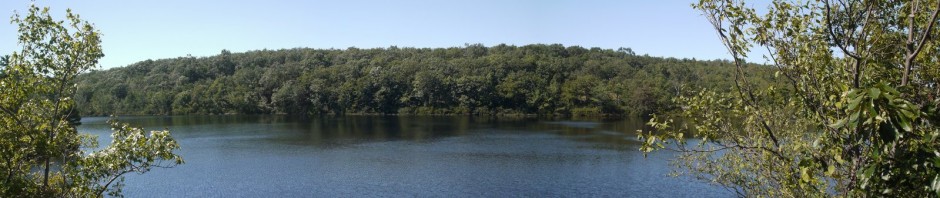
Here’s the view from my fourth floor room, facing north:

Northern view from my hotel room
Saturday: My friend Julie from law school flew into Flagstaff and checked into the hotel. We had last seen each other in Yosemite in 2010, where we went rafting on the Merced, hiked to the top of Half Dome, and explored the giant redwoods. That was such a great trip that we decided to plan another adventurous vacation in another famed national park. We therefore signed up with an outfitter, Canyoneers, for a white-water rafting trip on the Colorado River. Canyoneers had its orientation session in the late afternoon at the hotel, where we met one of our crew members and received valuable instructions on what belongings to bring on the boat and what to leave checked at the hotel. Canyoneers had previously given us a long list of items to bring, and I had purchased polypropylene thermal underwear tops and bottoms and a fleece jacket for the trip, though I wondered why I would need them considering that the air temperature at the bottom of the Grand Canyon would supposedly be as high as 110 degrees Fahrenheit, and only get as low as 70 degrees at night. After discussing this at the orientation session, I decided to leave the thermal underwear at the hotel. (Many of the passengers left luggage and belongings at the hotel.) I brought my fleece jacket, though I think that I only used it the second night–for a pillow.
Another important topic regarded the “bathroom facilities” on the river. The boats would stop one to three times a day for lunch and hikes, which would be a good time to go #1: “skirts up and pants down,” that is, women would walk along the shore upstream while men would walk downstream, and then upon finding a somewhat secluded spot would urinate in the river, rather than on dry ground. For #2, it was preferable to wait until we made camp, at which time the crew set out two portable toilets at different locations. These were not sex-segregated. A hand-washing station was placed at the beginning of the trails to the toilets, and if toilet paper was found there, that would mean that the toilet was available, so the user would take the paper to the toilet and then return it to the hand-washing station after using the facility.
Sunday: We met for breakfast around 6:00 a.m., then checked out of our rooms and boarded a comfortable bus for Lee’s Ferry, about 6:45 a.m. There were about 22 of us on the trip, plus four crew and two boats. Nine of the passengers (including Julie and I) had signed up for the “Upper Grand with Historic Phantom Ranch” trip, giving us 2-1/4 days of rafting, covering 89 miles, with the rest of the third day at Phantom Ranch, and the fourth day hiking out of the Canyon. The remainder of the group had signed up for a full 7 days of rafting, which would take them all the way through the Canyon, to Lake Mead, a trip covering 277 miles.
After 2-1/2 hours on the bus, with one rest stop at a gas station/convenience store, we arrived at Lee’s Ferry, close to the border with Utah and just 7.5 miles south of Glen Canyon Dam. Lee’s Ferry had been an important river crossing from the 1870s until 1928, and today is used by boats entering the Grand Canyon. We met our other three crew members and boarded Canyoneer’s motorized pontoon boats. These boats have aluminum frames with ample storage space and huge inflated rubber tubes providing buoyancy and protection from rocks. The motors are outboards of 30-40 hp.
Here’s a view while still on the beach, looking over the aft port. Around the center of the photo you may be able to see a tiny red ball. This is suspended in the air over the river by cables and marks mile zero of the Colorado into the Grand Canyon. (This was the only physical mile marker; the others that I will refer to were only marked on maps.)

Lee’s Ferry
10:04 a.m.: And we’re off . . . pulling away from the beach at Lee’s Ferry.

Leaving Lee’s Ferry
10:15 a.m.: Mile 1-4:

Mile 1-4
10:49 a.m.: Navajo Bridges come into view. There are two spans here, side-by-side. The original bridge (farthest from the camera) was built in 1929, and is now reserved for pedestrian traffic. On the way to Lee’s Ferry, we had driven over the second bridge (the closest to the camera), which had been added in 1995.

Navajo Bridges
12:21 p.m.: Mile 12: by this time we are already seeing a number of rock sequences: Moenkipi Formation, Kaibab Formation, Toroweap Formation, Coconino Sandstone, Hermit Formation and Esplanade Sandstone:

Mile 12
12:23 p.m.: A stitched panorama at mile 12:

Panorama at Mile 12
I had brought my belongings in a duffel bag, and Canyoneers lent us a dry bag which contained a sleeping bag and a tarp. After much pushing and prodding, my duffel bag fit into the dry bag. Canyoneers also lent us an ammo can (i.e., a government-surplus container that had once kept ammunition secure and dry). Whereas the dry bags would only be accessible to us upon reaching the camp site at the end of each day, the ammo cans would be accessible throughout the day as needed, and could therefore be used to store items such as sunscreen, silverware, etc. The dry bags and ammo cans all looked alike, except that the dry bags had a number painted or stitched onto them, and the ammo cans had a name labeled on them. My dry bag was #149 and my ammo can was “Bert Loper.” I wondered why the ammo cans weren’t numbered to match the dry bags, and I also wondered who Bert Loper was. Julie’s dry bag was #169, and her ammo can was labeled “Sinagua” (without water). Other ammo cans had labels such as “Condor,” and I realized that the names had some relationship to the Grand Canyon.We were also told that we could bring along a small waterproof bag that we could keep near us. I used mine to store my rain jacket and pants, though I later wondered if it made sense to store rain gear in a waterproof bag.
My dry bag was heavy, in part because of my size 13 boots. The only labor expected of the passengers was to help load and unload the boat and to set up and take down our tents at camp. When loading and unloading the boat, we would generally form a line between the boat and shore and pass the dry bags down the line. I therefore got to compare the weight of a number of dry bags, and some felt as heavy as mine, while others were very light. I wondered what the people who belonged to the light ones had packed and how they were managing.(As the people on the 7-day trip were rafting through to Lake Mead, they would not need boots, as they were not hiking out of the Canyon. It is therefore possible that those going on the shorter trip needed more supplies than those going for the entire week.)
12:27 p.m.: Julie and I (“Sinagua” and “Bert Loper”) started out riding in the back of the boat:

Still dry
12:33 p.m.: Mile 12-13:

Mile 12-13
We stopped for lunch shortly after this. Canyoneers provided a broad range of food, including vegetarian fare, and everyone was able to find something tasty to eat. After lunch, we returned to the boats and continued moving downstream. In the morning, Julie and I had watched from the back of the boat as other passengers (typically teenagers) sat up front, seemingly enjoying themselves as our boat passed through rapids. We wanted to also enjoy such an experience (as well as get photos of the white water), and therefore asked to change places after lunch.
I brought two cameras on the trip: my Panasonic FX35 that had served me so well at Bryce & Zion, and a Kodak EasyShare Sport, which is a new waterproof camera. I had originally thought that I would use the Kodak while in the boat and the Panasonic only while on dry land. However, I soon saw that when not going through rapids we were completely dry in the boat, and that even when going through rapids that little water was making it to the back of the boat. I therefore began to use my Panasonic more than the Kodak, as I believed the Panasonic has much better image quality. This turned out to be a very wise move, because on the third day I discovered that all of the 60 or so photos on the Kodak had somehow vanished. The camera software requires confirmation before deleting all images, so I don’t know how I could have done that by accident–maybe there is a glitch in the camera. In any case, I was very happy then that I had been using the Panasonic. While I’m a little disappointed at losing the 60 photos from the Kodak, I still came home with about 960 photos on the Panasonic, of which I’m using about 120 photos for these web pages. I would have been very distraught if I had taken hundreds of photos on the Kodak and then lost them all. I think that I had used the Kodak primarily for going through the rapids at the beginning of the trip, which is why I don’t have more such shots.
1:52 p.m.: House Rock Rapid, mile 17. By this time, after having gone through at least three earlier rapids, I decided that I would take a chance and keep using my Panasonic in the rapids. There were some rapids in which it was splashed with water, but I quickly patted the water off and it kept shooting.

House Rock Rapid, Mile 17
1:58 p.m.: Boulder Narrows, mile 18.5. In the next two photos, you can see a huge boulder of Toroweap sandstone that fell into the river at some point. It is about 30 feet long, and is the largest boulder in the river. Driftwood on top of it was deposited in a 1957 flood (before the Glen Canyon Dam regulated flows). From the shots, it doesn’t look as though there’s enough room to get by the boulder, but the river is so wide that there was actually plenty of room for our boat to squeeze past.:

Boulder Narrows, Mile 18.5
Getting closer to the Boulder:

Boulder Narrows, Mile 18.5
The canyon walls were getting higher, and we encountered additional rock formations: Wescogame Formation, Manakacha Formation and Watahornigi Formation.
2:16 p.m.: North Canyon Rapid, mile 20.8:

North Canyon Rapid, Mile 20.8
I guess this is why they call it white-water rafting:

Now we’re wet!
2:19 p.m.: 21 Mile Rapid:

21 Mile Rapid

21 Mile Rapid
2:25 p.m.: Mile 22:

Mile 22

Mile 22
2:28 p.m.: Supai Spire, 23 Mile Rapid & 23½ Mile Rapid. The Surprise Canyon Formation and Redwall Limestone formation appear for the first time between these two rapids:

Supai Spire, 23 Mile Rapid & 23½ Mile Rapid

Supai Spire, 23 Mile Rapid & 23½ Mile Rapid

23½ Mile Rapid
2:39 p.m.: Georgie or 24½ Mile Rapid–I’m not sure which.

Georgie or 24½ Mile Rapid
Julie (and others on the trip) got a kick out of hearing that I (or at least my ammo can) was “Bert Loper.” Julie said that it sounded like the name of an old guy. The answer was in the River Guide, which we had both read, but obviously neither of us remembered the name. Our two crew members (the other two were on the other boat, which was always running ahead of ours) would often tell us about the history or geology of the Canyon, and explained that Bert Loper had been a well-known boat builder, who somehow never got around to boating down the Colorado himself until he was 69 or 70 years old, around 1939. He enjoyed it so much that he vowed to return at age 80. He did so, in 1949, but flipped his boat at 24½ Mile Rapid and probably suffered a heart attack and died. His boat washed ashore sixteen miles downstream, and the weathered hulk remains there. His bones weren’t found until years later.
Incidentally, a number of hikers have died at Yosemite this year, and in past years people have died rafting in the Grand Canyon. But Julie and I do not think that we were risking our lives on these trips. At Yosemite, we stayed behind the safety fence at Vernal Fall, stayed within the chains climbing Half Dome, and descended Half Dome when we heard distant thunder. At the Grand Canyon, our outfitter has been in business for decades and is very professional. The boats were substantial, and while the motors were not especially powerful, they provided more power than oar-driven boats. The Colorado itself is probably also safer now than it was 50 years ago, before the river was dammed at Glen Canyon, as now the flow is controlled, based upon electricity and water demands downstream. So I think it is possible to have a fun and adventurous vacation without it actually being dangerous: just learn about the dangers and follow common sense.
2:59 p.m.: Julie and I quickly learned a few things about sitting in the bow. It is exhilarating to be in the front of the boat when it hits the rapids, with the boat bouncing like a roller coaster. (In fact, the frame of our boat was articulated, with a hinge allowing the front 1/3 of the boat to pitch at a different angle from the rear of the boat.) But we also learned that it is uncomfortable to be splashed by water that is 45 degrees Fahrenheit! The Colorado is that cold because the water feeding it is released through turbines deep below the surface of the dam. Also, as you can see, the sky had turned cloudy in the afternoon, and the temperature dropped and a cool wind descended upon our wet skin. After about an hour, we beat a retreat to the rear of the boat. When big fat (and cold) raindrops began pelting us, I put on my rain jacket, nor was I the only one to do so.

Donning Rain Jackets
4:20 p.m.: The rain soon passed, though, and we had nicer weather again. At mile 30, we found an available campsite and beached the boats. I believe this was either Fence Fault or Sand Pile campsite. Canyoneers provided good-quality Kelty two-man tents, which they carried in separate dry bags on the boat.
We learned that the high water flows (floods) that had occurred before the damming of the Colorado had moved sand from the river channel to sandbars, creating beaches. With the dam, flows are controlled, which means safer rafting but also no new deposits of sand, and as a consequence the beaches are eroding and being lost.

Sunday night’s campsite
There was a tiny hole in the rocks near my tent. After determining that there were no animals inside, I squeezed in and took a picture of the camp:

Camp as seen from tiny cave
4:41 p.m.: A stitched panorama of the camp, with the beach in the foreground, some tents visible at far right, one of our boats available just left of center, with the Colorado behind it, as well as the cliff face across the river:

Panorama of scenery at first campsite
8:08 p.m.: The moon rises over our camp:

Moonrise
While it had seemed warm once or twice, it didn’t feel as though it was over 100 degrees. In fact, it felt as though it had been hotter when I changed planes in Phoenix (which involved walking across the tarmac to the small commuter plane). No one had a thermometer, though two days later, at Phantom Ranch, a ranger would say that while the forecast had been for a high of 106, it had only gotten to 92 or 94. So it may be that we experienced below-average temperatures while we were there. Or it could be that I’m used to sweltering in 90-degree weather in the East, where we have high humidity, and that a similar temperature in the desert isn’t as uncomfortable, given the low humidity. A final factor could be that we were riding on the Colorado River which was 45 degrees, so that could have cooled off the air slightly in the immediate area of the river.
Next: Day Two below the Rim.